Multi-layer Flood Risk Management for Utrecht
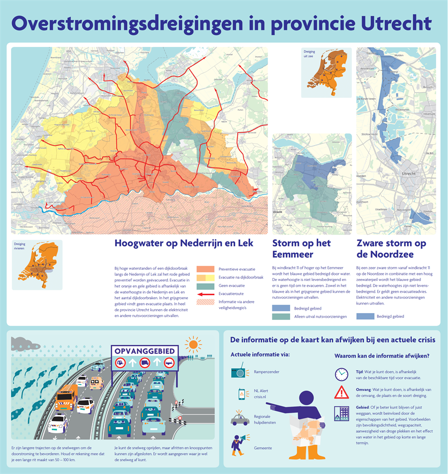
Utrecht Security Region has made a regional flood-risk map on which it gives its residents information on flooding, potentially affected locations and evacuation options within the region. The map also provides information on how people can prepare for a potential flood and make their way to safety. Different situations are sketched, such as the flooding of the river Lek and heavy rainfall. The flood-risk map is aimed at the public and citizens and is meant to inform them, to raise awareness, and to influence their understanding on how to respond.
Results
The map gives citizens and residents insight into locations that potentially could be affected by flooding and provides information on how to prepare well for the eventuality. Its aim is to ensure that residents prepare themselves as well as possible.
More information can be found on the website www.overstroomik.nl
Contact person
Elsbeth Beeke
Veiligheidsregio Utrecht
+31(0)6 53 64 27 23
e.beek@vru.nl