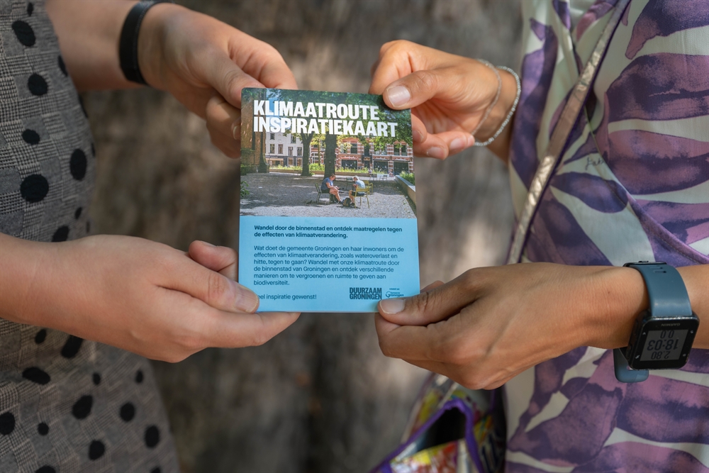
Roadmap takes you on a tour of climate adaptation projects in Groningen
The municipality of Groningen has compiled a “Climate route inspiration map”. This roadmap can be used to discover a range of appealing examples of local climate adaptation, on foot or by bicycle. The examples on the map can inspire users to take adaptation measures in their own environment.
What has prompted the Climate Route Inspiration Map?
The municipal council felt the need for a location in the city that focused attention on greening, in order to raise awareness. However, a single location would be rather static, whilst residents would be required to take the trouble of visiting that location during its opening hours. Furthermore, finding a suitable space would take time, and its lay-out would entail considerable additional costs. For that reason, the municipal Quality of Living department opted for an easily accessible solution which it considered more appropriate to this day and age: a paper map and a digital map outlining a route along climate adaptation projects in the municipality.
How exactly does it work?
One roadmap outlines a walking route through the city centre and another roadmap features a cycling route through the entire municipality. Both roadmaps are available in digital format on the popular Komoot navigation app. After downloading the app, you can view the maps via the QR code on the Sustainable Groningen website. This website also contains a wide range of information on greening measures and potential subsidies. The walking map is also available in a foldable paper version, which can be collected at the reception desk of the municipal office, Gedempte Zuiderdiep 98 in Groningen.

What type of examples are shown on the map?
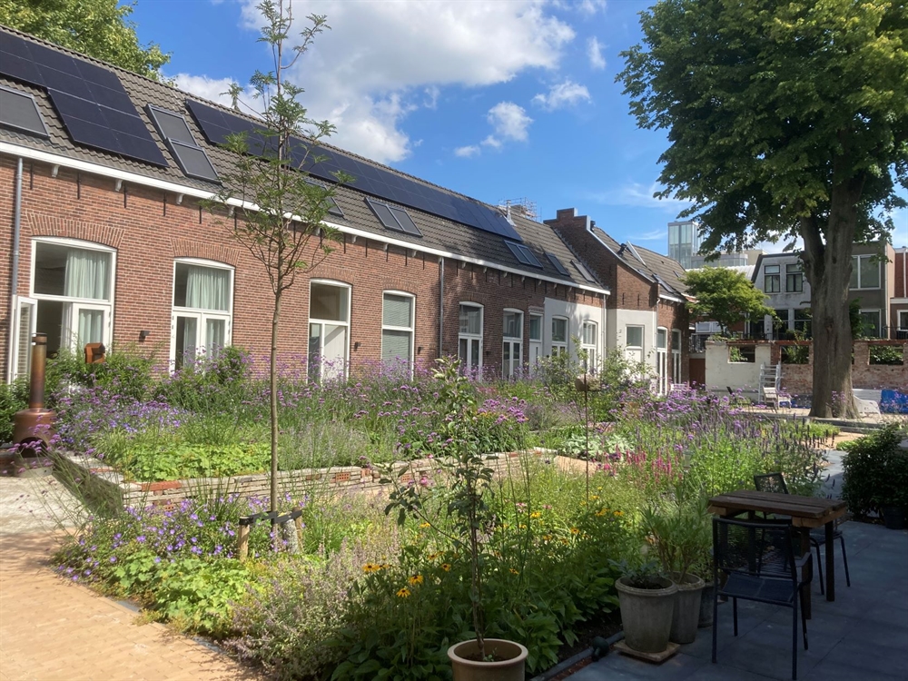
The examples on the map comprise, e.g., façade gardens; bioswales; water permeable pavement; green walls and rooftops; trees providing shade; and locations at which pavement has been replaced by greenery. All the measures are located along the route and can thus be viewed in actual practice. Information on each measure is provided on the map.
How is Groningen promoting the roadmaps?
The municipality of Groningen is promoting the roadmaps via its municipal newsletters, social media, and the Sustainable Groningen sustainability platform. In addition, the foldable maps are distributed at information markets. Supplementary to the map, next year the municipality intends to carry out its original idea and set up an exhibition of greening measures in the Sustainable Groningen presentation hall.
What were the costs of this project?
According to the municipality of Groningen, the costs of developing the “Climate Route Inspiration Map” amounted to approx. 3000 euros. Part of this sum was spent on college students who have digitised all the adaptation examples.
What lessons can be learned?
The Komoot app on which the maps are available appeared to lack in user-friendliness. Without using the QR code, finding the route on the map is quite difficult. Yet this was the best possible app. The municipality of Groningen opted for this app based on the students’ positive experience with using Komoot. Responsible alderwoman Mirjam Wijnja and council member Evelien Bernabela of the Partij voor het Noorden are positive regarding the result.
Contact person
Paul Loonstra
Gemeente Groningen
paul.loonstra@groningen.nl