Texel is expanding: unique and future-proof nature
The three-kilometre-long Prins Hendrik Dyke on the island of Texel no longer met the required safety standards and has been reinforced using an innovative nature-based approach with sand. A diverse sandy landscape has been created in front of the existing dyke, with a dynamic character that fits the Wadden Sea. The Prins Hendrik Sand Dyke project combines flood protection with nature development. The reinforcement provides a future-proof flood defence while enhancing the natural values of the Wadden Sea. Its flexible design allows the area to adapt to future changes, including sea level rise.
In 2006, several sections of the Texel Wadden Sea dyke no longer met the required safety standards. While most of the dyke was reinforced using traditional methods, a nature-based solution was chosen for the Prins Hendrik Dyke, the section between the Royal Netherlands Institute for Sea Research (NIOZ) and Oudeschild. This approach was proposed by several local organisations and interest groups on Texel. The Ministry of Infrastructure and Water Management, the Province of North Holland, the Wadden Fund, the Municipality of Texel and the Hollands Noorderkwartier District Water Board worked together to realise this unique dyke reinforcement project.
A row of dunes has been created on the seaward side of the dyke, with a diverse area of salt marshes and mudflats in front of it. This area provides resting, breeding and foraging habitat for a wide range of wading birds. The original dyke has lost its flood defence function but has been retained as a landscape feature. The flexible design of the sand dyke allows it to adapt to future changes, including new safety standards and sea level rise in the Wadden Sea.
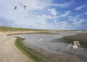
The Prins Hendrik sand dyke ties in with the preferential strategy for flood risk management of the Wadden Sea area set down in the Delta Plan: important values of the Wadden Sea area will be retained by opting for measures that are as natural as possible, while substantiating an integrated and area-specific implementation of measures at the regional level.
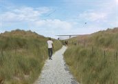
The construction works started in 2018 and were completed by the end of 2019. The project includes a new cycle path and footpath with a birdwatching point, allowing visitors to explore and enjoy the new landscape.
The contractor will remain responsible for maintenance of the project for five years. A comprehensive Management and Monitoring Plan has been set down for both the realisation phase and the maintenance phase.
Lessons learned from the project
- The sandy solution complies with the wishes of the municipality and interest groups on the island of Texel.
- Close collaboration and looking beyond the boundaries of individual taskings have resulted in an integrated, sustainable, broadly supported, and properly funded solution (including grants).
- The administrative willingness of project partners to take risks constitutes an important factor for success.
- The Hollands Noorderkwartier district water control board is realising the project on a risk-bearing basis.
- This is the first time a permit has been granted under the Nature Conservation Act for a development such as this one in the Natura 2000 Wadden Sea area. An appropriate “new style” assessment has been formulated, revolving around the so-called “adaptation strategy”.
Contactperson
Neeltje Annink
Hoogheemraadschap Hollands Noorderkwartier (HHNK)
n.annink@hhnk.nl
06 20 13 28 72