RadarTools
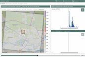
Water management bodies require reliable information on the impact of extreme downpours on the soil. For example, how does the damage relate to the duration of the downpour? How heavy was the downpour and where exactly did the water end up? And what does a downpour entail for the calculation models that are being used to simulate the impact of extreme weather? To this end, the RIONED Foundation and the Foundation for Applied Water Research STOWA have developed RadarTools. RadarTools is special software that helps to chart the impact of precipitation on the soil at the municipal level. This software enables authorities to take more efficient measures to combat the consequences of extreme downpours. RadarTools is available to anyone interested in finding out more about extreme downpours in the Netherlands: municipalities, district water boards, consultancies, insurance companies, landowners, and farmers. However, RadarTools can also be used by local residents who are just interested in extreme precipitation in their area.