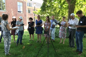
Thermal walk
A thermal walk is a research method that is used to map out the heat measured and perceived in a particular area, and to obtain answers to questions such as: how heat-proof is a particular walking route in the city, a shopping street, a residential area, the area around a train station, or a market square? A thermal walk maps out which planning layouts are hottest, coolest, most pleasant, and most unpleasant. One of the determining factors is the perceived temperature. Is a location situated in direct sunlight or is it shaded? In addition to air temperature and perceived temperature, the thermal walk considers thermal perception, i.e., how is a particular location perceived in terms of heat? The psychological effect is another important factor in heat-proof spatial planning.
The thermal walk is an efficient method to have outdoor planners explore and experience how greenery, water, and space impact the air temperature, the perceived temperature, and thermal perception. In addition, the thermal walk can be used to explore heat issues together with colleagues and municipal authorities, and to initiate a risk dialogue.
During a Thermal Walk, the participants visit several locations as elements of a walking route or in an area, at which they examine the thermal perception on the basis of a questionnaire. In addition, meteorological measurements are conducted in order to map out the air and perceived temperatures.
Read more on the Amsterdam University of Applied Sciences website.
Share this