How is the probability of flooding increasing?

The probability of flooding is mainly increasing as a result of the rising sea level and increasing river discharge volumes. Together, the rising sea level and higher river discharge volumes cause river water levels to rise. Higher water levels add to the probability of flooding from inland waterways, such as tributary rivers and brooks. The probability is highest in winter, as river discharge volumes will increase during the winter. The paragraphs below provide more details on how sharply the sea level is rising, what is causing this rise, and why river discharge volumes are increasing.

The Sea Level Rise Knowledge Programme is exploring the potential consequences of sea level rise for the Netherlands. Under this programme, government authorities, research institutes, businesses, and NGOs are collectively exploring various scenarios regarding the pace and extent of sea level rise. Furthermore, they are studying the potential consequences for our country. The programme generates knowledge that will enable us to make choices with respect to the protection and spatial planning of the Netherlands.

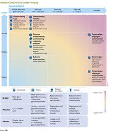
Small probability of flooding from the sea or major rivers

In protected areas, the risk of flooding is fairly low, as the safety standards for primary flood defences have been tightened. Primary flood defences protect our country against water from the North Sea, the Wadden Sea, the major rivers, and the IJsselmeer and Markermeer lakes. These flood defences will be reinforced until 2050 in order to meet the new standards. However, should a primary flood defence system fail nonetheless, the consequences may be detrimental, as the diagram below shows.

This risk diagram has been derived from the National Risk Analysis, special report on the climate and natural disasters (2022). This shows that flooding from the sea is unlikely yet will have a catastrophic impact, whilst flooding from rivers is possible and will have very serious consequences.

How quickly is the sea level rising?

The earth is warming as a result of carbon dioxide (CO2) emissions. Global warming causes water in the oceans to expand and ice sheets to melt. This is causing the sea level to rise. The rise is already manifest and will increase further in the future. Do you want to know by how much the sea level off the Dutch coast has risen? And how this rise relates to the worldwide rise? Or do you want to know the future sea level scenarios? Such information is provided in the KNMI climate dashboard. The dashboard contains two diagrams: a national diagram and a diagram comparing the sea level off the Dutch coast to the worldwide sea level.

By how much has the sea level already risen?

According to the KNMI'23 climate scenarios the worldwide sea level has risen since 1900 by an average of 20 cm, i.e., an average rise of 1.7 mm annually. However, towards the end of the 1960s, a considerable acceleration set in all across the globe: between 2006 and 2018, the annual rise worldwide averaged 3.7 mm. Initially, no significant rise was found off the Dutch coast, but according to recent studies conducted by Deltares, KNMI, and Delft University of Technology, the sea level off the Dutch coast has been rising more sharply since the early 1990s. According to the Deltares Sea Level Monitor 2022, since 1993, the sea level has been rising by 2.9 mm annually, versus an annual rise of  1.86 mm previously.

By how much is the sea level still going to rise this century?

Will we continue to emit large volumes of CO2 in the years ahead? Then up to 2100, the sea level off the Dutch coast may rise by between 59 cm to 124 cm vis-à-vis the beginning of this century. If we reduce our CO2 emissions, the sea level will rise by between 26 cm to 73 cm. More information on this topic can be found in the brochure of the KNMI'23 climate scenarios. In addition to COemissions, other – uncertain – processes may cause the sea level to rise even more. For example, if parts of the Antarctic ice sheet become unstable, and if the ice sheet starts melting at an accelerated pace, this may even cause the sea level to rise by 2.5 metres by 2100.

The Dutch Caribbean Dutch islands of Bonaire, Saba and Sint Eustatius also face sharply rising sea levels. The KNMI'23 climate scenarios show that sea level at Bonaire 2100 will rise between 31 cm and 78 cm under a low greenhouse gas emission scenario and between 55 cm and 127 cm under a high emission scenario. The upper limit could rise to 3.4 metres if the Antarctic ice sheet becomes unstable. Slightly less sea level rise is expected for Saba and Sint Eustatius.

How fast will the sea level rise after 2100?

In the long term, the sea level will continue to rise, even if we achieve a considerable reduction in CO2 emissions and manage to limit global warming to a maximum of 2⁰C, as per the international agreements. This is because the oceans and ice sheets are slow to respond to global warming. Such processes cannot be stopped just like that. The KNMI'23 climate scenarios show the following potential scenarios for 2300:

  • If CO2 emissions are significantly reduced, the worldwide sea level will have risen by an average of 0.3 to 3 metres by 2300;
  • Under a high emissions scenario, sea level rise around 2300 is 2 to 6 metres;
  • If uncertain ice sheet processes in Antarctica are also included, the worldwide sea level rise may increase to 17 metres.

Expectations are that the sea level will not be in balance with the climate until 10,000 years from now, and will continue to rise until such time, even if we cease our greenhouse gas emissions now. If we manage to keep global warming to 2⁰C, the worldwide sea level will have risen by 6 m to 7 m by that time. At 3⁰C global warming, it will have risen by 10 m to 24 m, and at 5⁰C global warming by 28 m to 37 m.

What causes the sea level to rise?

The sea level is rising because Earth is warming. This warming is caused by the large volumes of CO2 being emitted. Via a range of processes, global warming is contributing to the rise in sea level:

  • The warmer air warms the seawater. As water warms, it expands. Ergo, warmer seawater takes up more room and thus, the sea level will rise.
  • Global warming causes Greenland and Antarctic glaciers and ice sheets to melt. This adds more seawater to the oceans, which causes the sea level to rise. According to the KNMI'23 climate scenarios, the ice sheets are melting at an accelerated pace.
  • Global warming causes more changes, most of which have a regional impact, such as changes in ocean currents. Furthermore, melting ice sheets and sea ice reduce the salinity of seawater. The density of seawater is proportional to its salinity; less saline seawater will expand in volume.

In addition to these effects of global warming, soil subsidence may also play a part. In the Netherlands, the soil is subsiding, which causes a proportional rise in sea level. According to the Sea Level Monitor 2022, an average 0.45 mm of sea level rise can be attributed to soil subsidence.

Why are river discharge volumes increasing?

The increase in river discharge volumes can primarily be attributed to increasing precipitation. This, in turn, is largely caused by global warming: warmer air can hold more moisture. More information on increasing precipitation is provided in the Knowledge Dossier on Waterlogging. Other factors affecting river discharges are: melting snow, evaporation in the catchment area, and water management.

How is increasing precipitation resulting in higher river water levels?

High water – high river water levels – can lead to flooding. This is how increasing precipitation can add to the probability of high water in the Netherlands:

  • According to the KNMI'23 climate scenarios, average winter precipitation in the Rhine and Meuse basins is increasing. Consequently, the rivers will discharge more water in winter. Concurrently, average summer precipitation will decrease in the basins, resulting in lower average river discharges in summer. This is also reflected in research from 2023 in which Rijkswaterstaat calculated what the KNMI scenarios mean for river discharges in 2050, 2100 and 2150.
  • Climate change is adding to the probability of extreme summer precipitation. According to international research, the probability of flooding, as in July 2021, will increase.

What can we learn from the flooding in July 2021?

In July 2021, parts of Belgium, Germany, and the Dutch province of Limburg were flooded. The cause: extreme rainfall on 13 and 14 July in the Meuse and Rhine basins. These floods have prompted a range of studies:

  • An international team of scientists has explored whether climate change is adding to the probability of flooding as a result of severe summer rainfall. According to their study, climate change is increasing the probability of severe rainfall somewhere in the region between the North Alps and the Netherlands, reaching a level similar to the precipitation of 13 and 14 July 2021. This raises the probability of flooding caused by extreme precipitation.
  • Deltares has researched whether the highly extreme precipitation that fell in the Rhine and Meuse basins in July 2021 could also occur in the central part of the Netherlands, and what the consequences would be. The conclusion: yes, this may happen, even though it is slightly less probable. Such precipitation would have a major impact, as it has had in Belgium, Germany, and Limburg. According to the study, we need to prepare better, in several ways, to prevent a disaster in such situations. The researchers have presented seven recommendations in this respect, such as: conducting stress tests at a supra-regional scale; assessing disaster management capacities; and boosting the exchange of risk information across the borders.